A quick idea of what we learned -- The Cook Islands are part of the British Commonwealth and were named after Captain James Cook, who sighted them in 1770. History says that the islands became a British protectorate in 1888, to keep them from being absorbed into what is now called French Polynesia. By 1900, administrative control was transferred to New Zealand and, in 1965, residents chose self-government in free association with New Zealand. The Cook Islands are fully responsible for their own internal affairs, while New Zealand retains responsibility for external affairs and defense.
There are 15 islands making up this country located partway between Fiji and Tahiti in the Central South Pacific Ocean. The two largest islands are Rarotonga and Aitutaki, which were our port stops yesterday and today.
Tuesday, March 13, 2018 -- Rarotonga
We got lucky today, as the seas calmed down, and we were able to anchor offshore on the northern side of the island of Rarotonga and successfully take a tender boat ride into the small docking area at Avarua, capital city of the Cook Islands. As many experienced cruisers (including the two of us) can tell you, ships often miss port calls here due to rough/choppy water conditions. That wasn’t the case today. Admittedly, it was cloudy, with occasional light rain, but we still had a very good visit.

When we reached shore, it was lightly raining, but we quickly found the minibus for our shore excursion, “Rarotonga Highlights & Cultural Performance.” We had an excellent tour guide named Kapi. He was born and raised on Rarotonga but then moved to New Zealand, as many Polynesian islanders do. When both of his parents died, he returned to Rarotonga because all land in the Cook Islands belongs to families. He was heir to the land, and he didn’t want it to leave his family. In this regard, it was also interesting that no land belongs to the government, and land cannot be sold to foreigners. For example, lands for the hospital, airport, and government buildings are all leased from the owning families. When the lease expires, it must be renegotiated. Cemeteries are owned by churches.
Kapi began the tour by driving on the “main road” that circles the island for its full 20-mile circumference. That’s a nice road, but he soon had the driver turn off this road onto what are called “inland roads.” Back off the main road is where most people live.

Everything on this island is green and many crops are growing – we saw bananas, papaya, mangos, tapioca, oranges, and noni being grown on small family-size plots. Here are some dragon-fruit plants.

We drove through an interesting area near the National Auditorium where each of the buildings is owned by a different one of the Cook Islands. When the people come to visit Rarotonga, they can stay in these houses, especially during national festivals.
After that, our first stop was at Ngatangilia Harbor, on the southern part of the island. Our guide told us that, according to oral traditions in the Cook Islands, Polynesian voyagers (Maori) left from this spot on Rarotonga around the year 1350 in giant canoes and settled in the new land they called Aotearoa (now called New Zealand). The story says that each canoe held 150 to 200 people, along with food, water, and animals. There are commemorative signs and plaques at this site, and periodic festivals are held. Interestingly, we have read that Rarotonga islanders are of the same Polynesian stock as the Maoris.
We made a lengthy stop at a large clubhouse for tasting many of the native Rarotonga fruits, followed by a cultural dance show, with five different-size hollow logs being used as drums to set the beat for a group of six dancers (4 guys and two girls). They did a lot of dances – very fast with a lot of shaking going on. We thought it was much like what we think of as Tahitian dancing, but Kapi said the Tahitians are copying the Cook Islands dancers.


On the way back to the tender port we drove past many resorts and hotels near Muri Beach, which has a large lagoon surrounded by a coral reef making it popular for swimming, snorkeling, and boating. Kapi said that 60% of all visitor accommodations are in this area; but, there are no private beaches on Rarotonga. Beaches are open and available for everyone.
Tourism is the Cook Island's main industry, and the biggest element of the economy. We drove by the large international airport, which was originally built by American military forces during World War II and then improved by New Zealand in 1974. There are frequent interisland flights as well as international flights to and from Papeete, Auckland, Sydney, and Los Angeles.
Wednesday, March 14, 2018 – Aitutaki, Cook Islands
Aitutaki is the second largest of the Cook Islands, after Rarotonga. The main feature of Aitutaki is a barrier reef surrounding a large blue turquois lagoon and the main island. The barrier reef is roughly the shape of an equilateral triangle with sides 7.5 miles in length. The southern edge of the triangle is almost totally below the surface of the ocean, and the eastern side is composed of a string of small islands called motu. Some people call this lagoon at Aitutaki the most beautiful of its type in the world, and we were lucky enough to see it today.
Tourism is the Cook Island's main industry, and the biggest element of the economy. We drove by the large international airport, which was originally built by American military forces during World War II and then improved by New Zealand in 1974. There are frequent interisland flights as well as international flights to and from Papeete, Auckland, Sydney, and Los Angeles.
Aitutaki is the second largest of the Cook Islands, after Rarotonga. The main feature of Aitutaki is a barrier reef surrounding a large blue turquois lagoon and the main island. The barrier reef is roughly the shape of an equilateral triangle with sides 7.5 miles in length. The southern edge of the triangle is almost totally below the surface of the ocean, and the eastern side is composed of a string of small islands called motu. Some people call this lagoon at Aitutaki the most beautiful of its type in the world, and we were lucky enough to see it today.


To get an idea of the topography, the total land area of Aitutaki Island is about seven square miles, and the area of the lagoon surrounding it is 29 square miles. Some of our fellow passengers with whom we talked went snorkeling today and raved about the shallow, warm turquoise waters, coral formations, tropical fish, and bright blue skies.
The two of us went on a 4-hour Crystal shore excursion today called “Aitutaki Acquaintance,” which required a tender boat ride through the break in the coral reef and the channel in the lagoon to Arutunga. That was uneventful. There were six small minibuses on the tour. Our driver-guide was chatty, but didn’t pass along much information of value. However, we did see a lot of scenery along the drive, which was quite rural. Houses were small, basic, and almost all were collecting rain water off their roofs, because the public water supply isn’t enough. Aitutaki is subdivided into eight villages, and we drove through most of them on our way around the island. Our first stop was at the oldest church – the Cook Islands Christian Church – founded by the first missionaries to arrive in 1821.
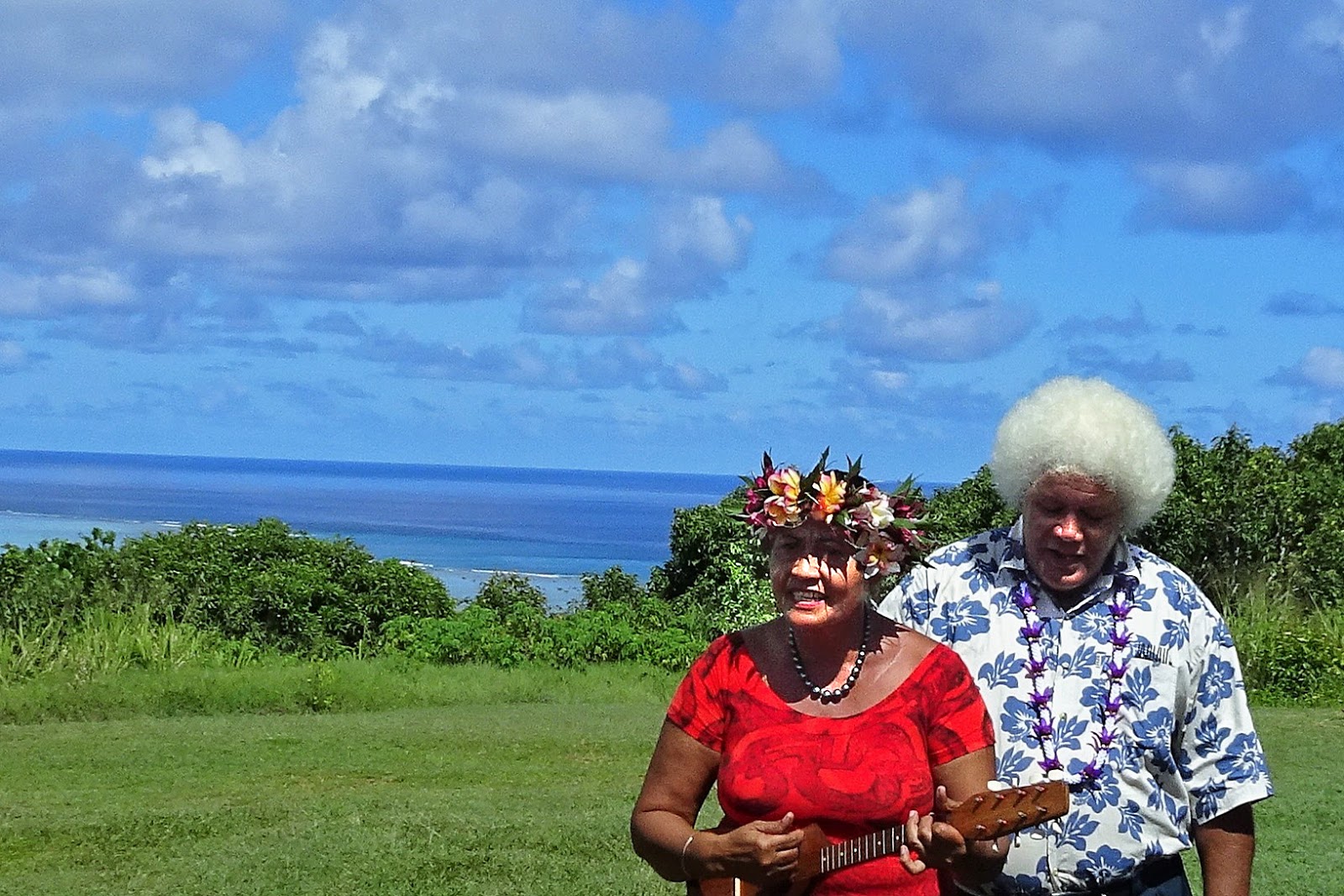
We then stopped at a natural wonder – a giant Banyan tree in the village of Tautu Vaipae, that has grown above and over the road in a natural arch. We all hopped off the small minibus to snap photos. Next was a drive up to the second highest hill on the island for a look at the view. While here, one of the guides talked about how to put flowers in your hair, and what they mean. Then she sang a few songs with her ukulele. Another guide showed us how to husk a coconut (similar to what we saw on Tonga).


It was a good visit, but we felt that we just scratched the surface. Despite the large brilliant turquoise lagoon, 15 palm-covered motu (islets) to explore, and beautiful beaches, the island has been spared from mass tourism and it seems like a quiet place. It’s definitely not commercialized.
This was a “maiden call” for Crystal at Aitutaki – the first visit by Crystal to this site. We heard on the island that they average seeing a cruise ship here maybe nine times per year, and Symphony might be the largest cruise ship ever to come here. We had read in advance that Aitutaki is “The South Pacific's best kept secret.” We were glad to have seen this unique, picturesque tropical paradise setting.
Our next stop, in two days, will be another tropical paradise – Bora Bora in French Polynesia.
Jim & Ginny
No comments:
Post a Comment