Pages

Tuesday, February 27, 2018

February 27, 2018 – Napier, New Zealand

The Captain docked Crystal Symphony into the cargo port in Napier this morning at 8:00 and, once again, we saw immediately that one of the major exports from Napier is timber. Docked very near us was a very large, specially-designed cargo ship being loaded with logs.


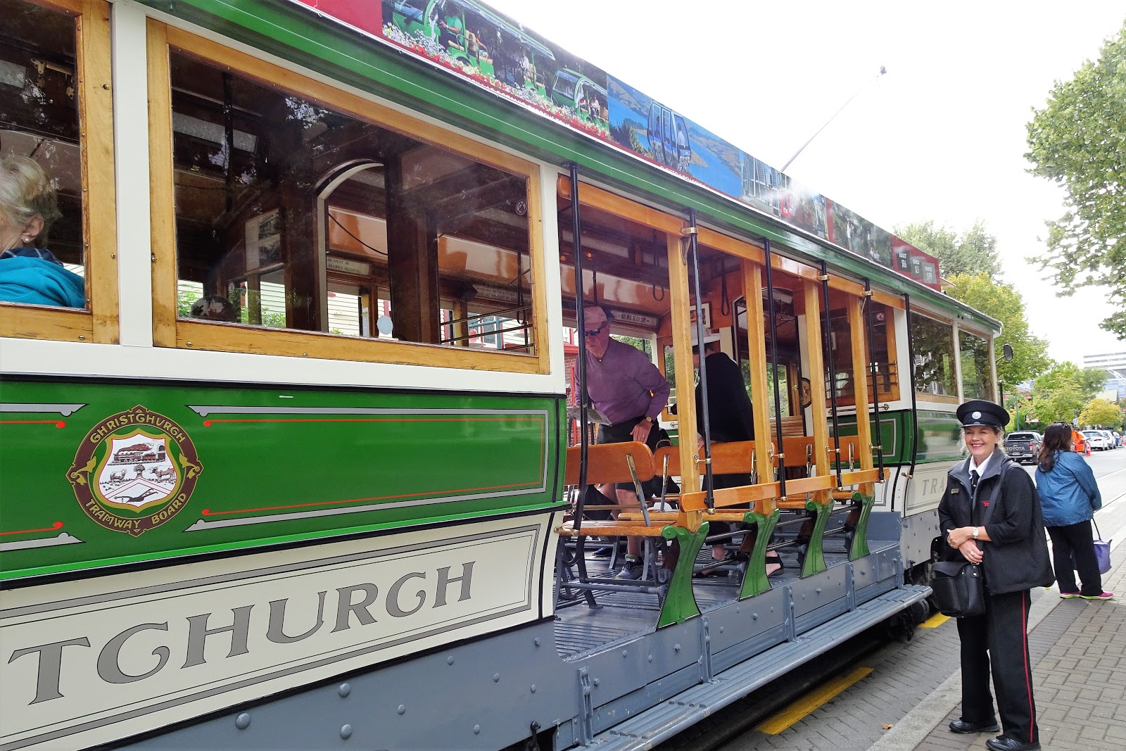
We last visited Napier five years ago and remember it as being a modern, attractive town with an interesting history. The town was almost totally leveled by a deadly 7.9 magnitude earthquake and a resulting fire back in 1931. When it was rebuilt after the disaster, a popular architectural style of the time – Art Deco – was used in many parts of town. Population of Napier is now 58,000 people.

The other good memory we had of Napier five years ago was a colorful Scottish marching band competition. We spent at least an hour watching this, and heard more bagpipes and Scottish drums than we could have imagined in one spot at one time. We had no such luck today, as there were no competitions scheduled.

We did a great 5-hour shore excursion today titled, “Clifton Sheep Station & Countryside Drive.” An excellent driver/guide named Ian drove us all around the fertile Heretaunga Plain, which lies west of Napier between Hawke’s Bay and the mountains.

Anyone familiar with the Hawke's Bay name would immediately think about the wine grown, produced and bottled here. Ian told us that this is the second largest wine-producing region in New Zealand, after only Marlborough. We rode by many vineyards along the way, including Beach House, Elephant Hill, Te Mata, Black Barn, Red Barrel, and Clearview. There were more, but these are the names we remember. We saw many fields of peaches and other stone fruits, kiwi (their biggest fruit export) and maize, as well as many sheep and cattle grazing. This is also the largest apple growing region in New Zealand.

After about 30 minutes, we arrived at the Clifton Sheep Station, a farm that has been run by the Gordon family for five generations. The farm was large – 2,500 acres – and they have about 4,000 head of Romney Sheep, as well as some cattle. Our host was Tommy Gordon, who started the visit with a demonstration of how his dogs round up a flock of sheep. He showed us three of his dogs – one short-hair border collie (the primary shepherd dog today), one Rottweiler mix (the huntaway), and one small fox terrier (which stayed by Tommy’s side today). All the dogs react to loud, shrill whistles from their owner. The shepherd dog didn’t bark, but gathered the sheep by staring at them, eye to eye. The huntaway dog specializes in barking at other animals to keep them away from the flock, but today he did bark a lot. The dogs did a perfect job finding the flock and herding them back to where we were watching.


Then we moved into a barn to watch a sheep shearing demonstration. Tommy held the large sheep against his body, so that she would relax. He wore special shoes, and the sheep was on his feet. He used an electric shearer that looked something like the electric hair clipper we see when we get a haircut in a barber shop. It looked like a lot of work to hold that sheep somewhat steady during the shearing. He went fairly slow for us, but we were told that an average shearer can do about 250 sheep per day, and the best can get up to 600 – 700 in a day. The sheep are sheared once every eight months, at different lengths, depending on the time of year. They pack the wool in bales that go to auction houses, and they’re paid depending on the winning bids.


After all that hard work while (watching) the shearing, we walked down the road to a rustic building called the Clifton Bay Café, along the waterfront, with views of Cape Kidnappers (so-named by Captain Cook). Here we were treated to fresh-baked scones with raspberry jam and cream, along with tea or coffee.

When leaving the farm, we traveled via Tuki Tuki Valley and up to the summit of Te Mata Peak at about 1,200 feet. It was a steep, narrow ride to the top, but Ian handled it perfectly and views of the valley below were superb. This must be a favorite area for local people, as there were kids here on a school outing, and there were many (challenging) walking trails.


Our final stop was in the countryside near the pretty township of Havelock North, where we stopped at a small roadside cluster of buildings called Birdside Gallery. We enjoyed sampling cups of homemade wild berry ice cream, which were delicious. We also looked through the gallery of art products and handicrafts, and visited another shop with confections.

We returned to Napier and admired the many attractions along the Marine Parade promenade ─ a long swath of green grass, public recreation sites, fountains, playgrounds, etc. ─ along the waters of Hawke's Bay between the highway and the water. We assume this (and the highway) were built on land reclaimed after the earthquake. These days it’s definitely a great place for strolling, relaxing, and other fun activities.

Napier still looks like a wonderful, fun little town. We wish we could have spent more time here, but our excursion today was also a great adventure.

We’ve been extra busy with all the New Zealand port stops coming one right after another and haven’t mentioned everything we’ve been doing onboard Crystal Symphony. The most notable event was a wonderful special function for full-world-cruise passengers only, back on Sunday, Feb 25th at Silk Restaurant on Deck 11. The event was called “Hooray for Hollywood” and included cocktails, dinner, and a show done by the World Cruise Entertainment Team. We greatly enjoyed the entire evening. Each course was tied to a movie and the dancers were dressed like famous actresses. There were songs sung between each course. The food was gourmet quality and unusual; for example, edible gold foil on our Indian dessert. Thanks go to Sarah Hayes, the World Cruise Hostess and Jonathon Hawkins, World Cruise Special Event Coordinator, who not only organized the event but also entertained us with their singing. Both are entertainers from the New York City area.


Tomorrow, we were scheduled for anchoring offshore at Gisborne, but sea conditions are predicted to not be favorable for safe operations of the tender boats to get us to shore. The Captain decided to not risk life or limb, so he will be skipping that port and will proceed to Tauranga.

Jim & Ginny

Monday, February 26, 2018

February 26, 2018 – Wellington, New Zealand

In this posting, we’ll describe two consecutive days on the opposite sides of the Cook Strait: first Nelson, at the northern end of New Zealand’s South Island, and then Wellington, on the southeast tip of the North Island.

Nelson, New Zealand ─ February 25, 2018
Sandwiched between our stops at two major New Zealand cities (Christchurch and Wellington), the visit at Nelson today was a welcome relief. This is a small town of approximately 51,000 residents (if the residents of the adjoining town of Richmond are included). Nelson has a reputation as the sunniest city in New Zealand, and it lived up to that today, with a very pleasant, sunny day. High temperature was 70°F (21°C).

English colonists first settled here in 1842. The city’s name honors British Admiral Horatio Nelson and his naval career in the Napoleonic Wars. 

We decided to explore Nelson on our own and took the shuttle bus into town from the industrial port where the ship was docked. The bus dropped us off, once again, at the i-SITE Tourist Information Center. Armed with the map that Crystal provides for each port stop, we decided to walk along Trafalgar Street all the way to the Anglican Cathedral, about ½ mile. This turned out to be a good decision, as this was the north-south oriented main street of town, with dozens of small stores, cafes, and art galleries to see. It was very crowded today with many local citizens meeting friends for lunch or just wandering around on such a beautiful day. At about the halfway point, we diverted over to Montgomery Square to check out the Nelson Sunday Market, which turned out to be something like a flea market.


Ginny remained at the market, while Jim returned to Trafalgar Street and walked up to the top of the hill on which the Cathedral sits. The cathedral has a 100-foot tall tower, and its construction was completed in 1965.

Wooden steps were first erected to the top of the Cathedral’s hill in 1858. They were replaced with granite steps in 1913 that are still in use today, and we understand they are a focal point for the city, serving as a stage for many purposes ─ such as celebrations, receptions, protests, a lunch spot.


We learned that the town of Nelson is known as an arts center, with hundreds of writers, artists, and other creative people living here. Of course, as in the rest of New Zealand, there is also much to enjoy here in the way of outdoor activities, to include hiking, fishing, kayaking, etc. There are three national parks nearby, as well as splendid sandy beaches, and the world-famous Marlborough wine region is easily reached from Nelson.

We returned to the i-SITE location to buy our obligatory souvenir refrigerator magnet and headed back to the port on the shuttle bus. Without exception, everyone we talked to on the ship about Nelson thought it was a wonderful town that they enjoyed visiting.

Symphony was docked in an unusually large container port for such a small town. Here is a panorama photo of the Nelson container port, taken from our stateroom balcony:


As we’ve seen in almost every port in New Zealand there are immense piles of timber stacked up here, ready for shipment to Asia – primarily China and Japan. Here’s what it looks like here in Nelson:


We’ve been told that New Zealanders are not depleting their hardwood forests. They have hundreds of thousands of acres of Monterey Pine tree farms in the country. These were originally imported from California, but they grow much faster in New Zealand – 30 years from planting to harvest (compared to 90 years in California). A new Monterey Pine tree is planted for each that is harvested.

Wellington, New Zealand ─ February 26, 2018
We crossed Cook Strait overnight, heading on an easterly course. This strait is notorious for choppy seas between New Zealand’s North and South Islands; and it was, in fact, a windy crossing with rough seas. The strait is only 20 miles wide, and it’s something like a wind tunnel at times, with wind funneling between the two mountainous land masses.

Wellington is the capital of New Zealand and is located almost exactly at the center of the country. Two other claims it can make -- Wellington is the southernmost capitol city in the world; and, because of its location near the Cook Strait, it is often called the windiest city in the world.

Crystal Symphony pulled in at the port at Wellington and docked on time at 8:00 a.m. The weather forecast for Wellington was for a 100% chance of rain today and, in fact, it was quite rainy, windy, and cold, this morning.

Our travel agent back home is a member of a consortium of agents called the Signature Collection. Signature arranged for a private half-day tour for us today in Wellington. Our car driver “John” and tour guide “John” were waiting for us as we disembarked the ship. Their 4‑hour private tour was great, although we and the guide modified the planned itinerary a lot, based on weather conditions.

During the course of our visit, we were driven through much of downtown, and we were able to get a sense of the city and the government buildings. This was quite a contrast to all the previous stops we’ve made in New Zealand. This is a modern and sophisticated city -- home to the government, embassies, first-class restaurants, and museums, along with steel and glass skyscrapers. Due to how the city is tucked in between water and the harbor to the south, and tall hills surrounding the city, there are many steep streets and cliff-hanging houses. Level land in Wellington has apparently become a rarity.

We mutually agreed to skip one of the major attractions that was on our itinerary – the Wellington Cable Car to the Kelburn Lookout and the top entrance of the Botanic Garden, where there are supposed to be great views. Today, in the rain, there would have been no views.

We didn’t take many photos today, because we didn’t want our camera to get wet.

Our first stop was at Old St. Paul’s Church, which our guide called “One of the finest examples of timber Gothic Revival architecture in the world.” It is certainly a beautiful wooden structure; built in 1866 and served as Wellington’s Anglican church until 1964, when the building itself was “retired” and church’s functions were transferred to the much larger St. Paul’s Cathedral nearby. It was saved from demolition and is now owned by the government and serves as a place of spiritual significance for many. We were told there are still public events taking place here ─ for example, weddings, funerals, or concerts.

We passed by the nearby “Beehive” which houses the Prime Minister’s office and other high-ranking officials. It’s called this because its shape reminds some people of a traditional woven beehive. It was built in stages during the 1970’s.


We were able to get out of the car and spend a little time visiting the “Old Government Building,” which was completed in 1876, and served as home for government civil service functions until 1998. John told us that it now houses the Victoria University's Law School. Portions of the building, on the ground floor, have been restored to its 1907 appearance as a historical site, open to the public. The building was constructed of wood, even the exterior which looked like stucco to us. It was an interesting site, and we’re glad we stopped to look it over.


We then drove to the old site of U.S. forces during World War II. We have read that at any one time between mid-1942 and mid-1944 there were between 15,000 and 45,000 American servicemen serving in New Zealand. John mentioned a visit to this site by Eleanor Roosevelt in 1943, which is still remembered by people in Wellington.

We spent more than an hour at the extraordinary Museum of New Zealand Te Papa Tongarewa. John arranged for a one hour guided group tour of this world-class museum, and it was a whirlwind review of wonderful exhibits, encompassing history, nature, and art. Of most interest were those on Maori culture and legends. We also found the exhibit of a giant squid, which normally lives a kilometer deep in the ocean, to be amazing. In retrospect, the museum was a great introduction to New Zealand. It would probably take us two to three days to see everything, but the one-hour review was very worthwhile.


At the end of our 4-hour tour, we had just enough time to ride up to Zealandia wildlife sanctuary, but not to go into the park. Instead, we, the driver, and the guide went to the second-floor coffee shop of the entrance building to order a special New Zealand coffee and look over a small corner of the park.

The plan was to spend as much time indoors, out of the rain, as possible. We accomplished that and thought we saw a lot of New Zealand’s capital city and culture of the Kiwi people, as they call themselves.

Jim & Ginny


Sunday, February 25, 2018

February 24, 2018 – Christchurch, New Zealand

We’ve been looking forward to seeing Christchurch for some time. Jim visited here nearly 50 years ago and thought then that it must be one of the most wonderful places in the world to live – very much an English city, with far better weather, and green gardens everywhere. It had always been called “The Garden City,” with fully ⅓ of its land area devoted to greenspace – parks, gardens, and reserves. But we were apprehensive about what we’d see, after reading so much about the terrible devastation that occurred during the two severe earthquakes they experienced here, five months apart, in September 2010 and February 2011.

Quick history -- colonizers from the Church of England arrived here in 1850 to found a model church settlement. We understand that they had plans to build a city around a cathedral and college, on the model of Christ Church in Oxford. Today, it is the South Island’s largest city with a population of 375,000 -- the third largest city in all of New Zealand, after Auckland and Wellington.

Location – Christchurch lies on the east coast, near the center of the South Island of New Zealand, east of the Canterbury Plain. Christchurch has the Southern Alps to the West, and the Pacific Ocean to the east. We docked this morning at Lyttlelton, the gateway port for Christchurch.


We decided to go on our own into Christchurch, giving us time to wander around, and be sure to see those things in which we were interested. We caught the free shuttle bus, which took about 30 minutes to ride from the port to the central city. The shuttle dropped us off at the i-SITE Visitor Information Center, adjacent to the old Arts Center on Worcester Boulevard.


From there we purchased tickets to hop on an old vintage streetcar that runs on rails, named the Tram in Christchurch, for a 50-minute ride through the inner part of the city. We could use our ticket to hop on and hop off at any one of 17 stops. This was perfect for us – a great decision.


The tram driver gave an excellent commentary on the local landmarks and descriptions of the earthquake damage. They gave the impression that the city is bouncing back, but there is still a long way to go. It’s been seven years since the second (and most destructive) quake in February 2011, and many billions of dollars have been spent, but we still saw many vacant lots covered with rubble and buildings only half standing or just propped up. They are waiting for funding approval for repair or replacement


We were told that the 2011 earthquake brought down many buildings that had been damaged by the 2010 earthquake the previous September. Other buildings have been declared uninhabitable in the intervening years. More than half of the buildings in the central business district have since been demolished, including the city’s tallest building, a 20-story hotel. Of course, one of the biggest losses was the Christchurch Anglican Cathedral. Along the tram route, the driver pointed out the transitional place of worship, called the “Cardboard Cathedral.” 

After completing one loop of the tram, we hopped off at the closest stop for Canterbury Museum and the Botanic Garden. The museum has a notable collection of over 2 million items, including sections of the museum featuring Maori culture, the early colonizers, and natural history. Jim was especially interested in the section on Antarctic expeditions – Christchurch has been the gateway to Antarctica for over 100 years. After a lot of walking in the museum, we ate lunch at their café on the 4th floor.

The Botanic Garden is adjacent to the museum and is a large, magnificent green area in the city -- beautifully maintained and all-encompassing of flowers and trees from around the world, including a large section of native plantings. We were so happy to learn that at least this unique treasure of Christchurch survived the earthquakes nearly unscathed. In the interest of time (and our legs) we decided to take the 50-minute narrated Green Caterpillar tour of the gardens (an electrically-powered 20-person vehicle). The driver/guide was extraordinarily knowledgeable about what seemed like every plant and tree in the park. Cost for “seniors” was NZ$15.00 per person, and well worth it. The best parts of the gardens included the huge variety of plants, the immense rose garden, and the surprising number of Sequoia trees.


During the garden tour, we caught glimpses of the beautiful, meandering Avon River and people enjoying “punting” excursions on the river -- gliding down the river in a flat-bottomed boat with no keel, being pushed by a long pole wielded by a “punter” dressed in Edwardian fashion. This is definitely a highlight of Christchurch, but we settled for watching others enjoying the ride.


After our short visit, we can say that Christchurch is rebounding following the earthquakes, and there is a positive attitude, at least among the small sample of people we met. There seems to be a lot of creativity and innovation taking hold. We did see in many cases that old, historical properties are being replaced by modern, 21st century structures. Some of that is good, but well known international commercial brands seem to be filling spaces where local companies formerly existed. These are tough decisions, and we wish them well.

Tomorrow we continue to head north on New Zealand’s South Island to Nelson, all the way to 41 degrees south latitude. 

Jim & Ginny


Saturday, February 24, 2018

February 23, 2018 – Dunedin, New Zealand

We had a beautiful sail-in this morning. Dunedin lies 12 miles from the sea on the southeastern coast of the South Island of New Zealand, at the end of a deep and narrow fjord known as Otago Harbor. Cruise ships are unable to travel all the way inland to Dunedin, so we docked at a busy container port in the city of Port Chalmers, about midway to Dunedin. Docked next to us was an even larger cruise ship – Sea Princess. Also of interest in the port are all the piles of hardwood trees being shipped to China and Japan.


For our visit to Dunedin we booked a 6½ hour excursion with “Good Company Tours,” through our travel agent before leaving home in January. None of the Crystal shore excursions went to the two sites we wanted to visit—Larnach Castle and the Cadbury chocolate factory.

Upon disembarking the ship, we followed footprints painted on the road surface to a makeshift passenger terminal where we found Bill, the Good Company driver for our tour. There were about 25 people on the bus – most of whom were passengers from the Sea Princess. Unfortu­nately, many of them were coughing, hacking and sneezing. But, we pressed on, trying to avoid the worst coughers. Bill had been giving tours in Dunedin for 53 years; we think his bus may have been that old also. Anyway, he knew his way around town and had a lot of interesting and humorous stories for us.

Dunedin has a strong Scottish history, and they claim to have the largest concentration of Victorian and Edwardian architecture in New Zealand. But Dunedin isn’t all about history, as it is also home to the University of Otago, with about 23,000 students, according to Bill. During our drive through Dunedin, we stopped and walked a short distance on their very attractive campus.


We also stopped to look at what is claimed to be the steepest street in the world (Baldwin Street). Bill suggested that we not try to walk up the hill, as we might not live to talk about it. 


In Dunedin, we also stopped at the Octagon (an 8-sided plaza) which is the center of town, with a huge green lawn used for public events, concerts and parades. Also ringing the Octagon is a statue of Robert Burns, Dunedin’s Town Hall, the public library, an art gallery, St Paul's Anglican Cathedral, and various cafes and bars. 


Some quick history: Unlike the English settlement of the rest of New Zealand, Dunedin was founded by the Scottish Free Church (in 1848). Scottish settlers gave this community the name Dunedin, which we were told is the Scottish Gaelic name for Edinburgh. Dunedin's strong links to its Scottish heritage continue to this day; our driver, Bill, had a very strong Scottish brogue accent. In 1861, gold was discovered near Dunedin. Within four months, some 2,000 prospectors arrived by ship and crammed into this small community. Dunedin soon became New Zealand’s most prosperous city. Of course, the gold boom didn’t last forever, and growth slowed. Today, Dunedin has a population of 127,000 people (not counting students).

It was at least a 30-minute drive from Dunedin (mostly uphill) to Larnach Castle, New Zealand’s only “castle.” In our opinion, it isn’t really a castle, since it was built by a banker and politician, William Larnach, in 1871 as a very large mansion on a steep hill overlooking the Otago Peninsula. The castle has 43 rooms and an adjoining ballroom. Larnach spared no expense on this home, with materials and artists from around the world. The guided tour of the home lasted about one hour, and then we had time for lunch in the café which is located in the old ballroom.


The castle is now owned by a private family which has spent decades on its restoration. Entry fees help with maintenance and restoration costs. It is now one of the area’s premier visitor attractions. The castle’s tour guide, Robin, did an excellent job explaining the history of the castle and its many features.

Upon our return to Dunedin, Bill dropped off some people at a local brewery for a tour, along with others who just wanted to walk around town and catch the shuttle bus back to Port Chalmers on their own. We elected to tour the Cadbury’s Chocolate Factory for the Cadbury’s World Experience. The 1-hour tour explained the chocolate making process, liquid chocolate tasting, a chocolate waterfall in a tall silo (which Jim climbed halfway up in, to watch the process, while Ginny watched from below. They gave us samples of Cadbury products along the way. We may save them to give to our grandson Evan and granddaughter Erin (maybe). Or maybe we’ll be tempted to sample some of them along the way in the next two months.

Our last stop was to quickly visit the Dunedin Railway Station, built in what can only be called a Baroque style. Construction began in 1903, and the station was officially opened in 1906. During the city's most prosperous years this railway station was the country's busiest, handling as many as 100 trains each day. Now there are only a handful of local tourist trains in Dunedin every week. But it stands as a monument to Dunedin's Golden Days and is said to be New Zealand's most photographed building.


One interesting thing we heard from the Sea Princess passengers – they had tried to get into the same fjords we had visited earlier in the week (Milford, Doubtful, and Dusky), but they were unsuccessful. Their ship is a lot larger than ours (2,000 passengers compared to our 800). Maybe that was a factor. Anyway, they weren’t happy about it.

It was a long day, but we saw a lot. Now we’re looking forward to visiting Christchurch tomorrow.

Jim & Ginny


Friday, February 23, 2018

February 22, 2018 – Stewart Island, New Zealand

Our ship’s daily newspaper, titled Reflections, had a lead story today on Stewart Island subtitled “The Ends of the Earth” and, in a way, that’s true. Stewart Island (also known as Rakiura) is the third-largest island of New Zealand and lies 18 miles south of the much larger South Island, across the Foveaux Strait. We are now at 47° South latitude. As a point of reference in the northern hemisphere, Ottawa and Minneapolis are both at 45° N, and Bismarck, North Dakota is at 47°N. One difference from these three cities is that there isn’t any major land mass between Stewart Island and the South Pole (Antarctica).

Stewart Island is about the size of the city-state of Singapore, with a total population of slightly less than 400. Of that number, 322 live in the largest settlement of Oban, where we will be visiting today. The Symphony anchored off shore, and we came ashore via tender boats.


Based on all this, we ventured onto this island with low expectations. Boy, were we wrong! We greatly enjoyed our visit here and were surprised to learn that it is a popular destination for people interested in the outdoors – walking, hiking (backpacking), and fishing. Eighty-five percent of the land on the island is a national park, and other land is set aside for public or conservational use. Only about 3% of the land is available for housing or business use.

We signed up for a shore excursion on Stewart Island (sort of a “panoramic tour”) on a small, 20-person minibus and were very fortunate to have a fairly young Australian girl named Erin (probably in her 20’s) as a driver/guide. She had visited here, fallen in love with the pure natural environment, and moved to the island two years ago. She just bubbled with enthusiasm.


She told us there are only three primary roads in town. We covered them quickly and then headed out of town. An interesting statistic – there are only 17 miles of roads on the island, but there are 215 miles of what are called “walking tracks” on Stewart Island for hiking and backpacking. We saw backpackers of all ages everywhere we went on the island.


Here are some fun facts we learned from Erin:
- Almost everything in the way of food or other staples travel here on a freight boat, Visitors arrive either by fast ferry from the “mainland” (South Island) or via a small air strip used to deliver visitors (6 – 12 at a time) on very small airplanes. Emergency medical airlift is by these same planes or by helicopter.

- There are 30 students in a primary school, but no high school. HS students go to a boarding school on the “mainland” (South Island) Monday - Friday and travel back and forth by ferry.

- Water source for all homes is rain water. All have tanks to accumulate water.

- There is no crime and only one police officer.

- There is only one sports field and only one competitive game (rugby) is played per year, and it is a major community event.

- There are many kiwi birds on the island, but they only come out at night. We read (in another source) that there are more kiwis on the island than humans -- we didn’t see any of them today.

- Most original settlers were Scottish. There are two churches on the island – one Anglican, and one Presbyterian.

- During the summer season, the population doubles with tourists and (tourist-related) additional workers. The number of tourists is limited by the places they can stay (only one small hotel and a few rental cottages). Most tourists are “day-trippers” or backpackers who live in huts on the walking tracks.

For our visit, the weather was mostly sunny and pleasant, with a few periods of very light (misty) rain. Foliage was a very pretty green color. There are a few golden sand beaches, but the water is really too cold to swim in without wearing wetsuits. When the wind comes from out of the south, it can get chilly here; but Erin said that it never snows.


After the short, 90-minute tour, we had a good time walking around this apparently healthy, happy, conservation-minded community.

Jim & Ginny

Wednesday, February 21, 2018

February 21, 2018 – Fiordland, New Zealand

Cruising from Sydney the past two days, the Tasman Sea lived up to its advance billing as an area of strong winds and rough seas. The ship has been rocking and bobbing a lot, and it’s been difficult just to walk down the hallways. Jim checked the weather on our stateroom TV a couple of times yesterday (for just a moment each time). One time the wind was 51 knots and the second time it was 60 knots (59 mph and 69 mph respectively). We don’t know what the speed was the remainder of the day, but it was definitely windy and seas were choppy!

When we awakened early this morning for our full-day cruise through Fiordland, it was cloudy and gloomy, but not rainy – hooray!

At 7:00 a.m., the ship slowed down to pick up two pilots to guide the ship through the fjords today, along with an interpretive guide who give us a running verbal description of what we were seeing, over the ship’s loudspeaker system.

The area known as Fiordland is a remote wilderness region in the southwestern corner of the South Island of New Zealand. This part of South Island is dominated by snow-capped mountains called the Southern Alps, with glacier-carved and now ocean-flooded western valleys. New Zealand’s Fiordland National Park covers 3.1 million acres – nearly 5% of the nation’s total land mass – and was declared a World Heritage Area in 1986.

The name "Fiordland" obviously comes from a variant spelling of the Scandinavian word "fjord,” but we don’t know why it’s spelled differently. The original English settlers also mistakenly called the fjords to be “sounds.” They are definitely fjords, which are commonly defined as long, nar­row inlets with steep sides or cliffs, created by a glacier. We don’t know why New Zealand still calls them “sounds.” Tradition lives on.

Way back in history, glaciers covered this area, gouging and deepening U-shaped valleys through the mountains, until they eventually reached the sea. Sea water then filled into the valleys, forming fjords. Fiordland National Park contains 14 spectacular fjords along 125 miles of rugged mountainous terrain and coastline.

Our guide told us that weather here (between 44° and 46° South latitude) is dominated by frequent westerly wind flows. When moisture-laden air from the Tasman Sea reaches the mountains, it is forced to rise over the barrier of mountains. It then cools quickly and creates heavy rain and snow. Within the park, annual rainfall varies from 47 inches (in Te Anau) to 315 inches (in Milford Sound). He said that rain falls in Fiordland, on average, over 200 days each year. At Milford Sound, it rains 300 days per year. We got lucky today!

Much of the terrain in Fiordland is classified as temperate rain forest. Evergreen trees and shrubs cling to steep faces of hard rock covered only by a thin layer of peat – humus and moss.

Interestingly, within the fjords the heavy rainfall creates a permanent freshwater layer (about 130 feet deep) above the sea water. We were told that the freshwater layer appears to be black in color because tannin leachs into the fresh water as it flows downhill through vegetation on its way down to the fjord.

Captain James Cook and his crew were the first Europeans to set eyes on this dramatic part of the world in 1770 and 1773. During his 1773 voyage, he established a tiny settlement and spent five weeks in Dusky Sound. Cook mapped the area and named all the fjords. His names are still in use today.

Here is the route on which the local pilots led us today, visiting five of the “sounds” from north to south.


Crystal Symphony entered Milford Sound soon after 7:00 a.m. Milford runs inland from the Tasman Sea for about nine miles in length – the shortest of the “sounds.” It is narrow where we entered (600 yards wide) and then opens to about one mile in width at its widest point. Our destination lecturer told us that there are many walking trails within the park, and one of them at Milford Sound takes about four days to complete. He claims, however, that the scenery views are very rewarding. We were told depth of the water is about 1,000 feet.

Highlights of our cruise through Milford Sound include steep cliffs on both sides of the fjord and, of course, several waterfalls cascading hundreds of feet into the deep black fjord. Milford Sound has two permanent waterfalls ─ Lady Bowen Falls and Stirling Falls. Naturally, after heavy rain, temporary waterfalls run down the steep-sided rock faces that line the fiord. Nearby Mitre Peak is nearly one mile in elevation.


Following along on the map, after turning around and returning to the Tasman Sea from Milford Sound, we followed the mountainous coastline offshore on our port (left) side down to Thompson Sound. We turned into Thompson Sound at about 1:00 p.m. and cruised through a small passage into the much longer Doubtful Sound (about 25 miles in length). Doubtful is also the deepest of the fjords (about 1,400 feet deep). Our guide told us that this fjord is rich in animal life, including Bottlenose Dolphins, New Zealand Fur Seals, and Fiordland Crested Penguins, although we didn’t see any of them. Doubtful is apparently known for “The Sound of Silence.” There are no roads leading to Doubtful Sound as there are to Milford, so it’s isolated and there are less people visiting Doubtful. We exited Doubtful Sound at about 2:30, returning southbound along the coast, in the Tasman Sea.


Our next turn was into Breaksea Sound, which eventually joined into Dusky Sound, one of the largest and most remote of the wilderness areas in New Zealand. Dusky is 25 miles long and five miles wide at its widest point. Once again, there are no roads reaching Dusky Sound. Access by sea or air only. It’s known as a haven for endangered species. We entered Breaksea Sound at 4:00 p.m. and almost immediately saw a large pod of dolphins (at least 10 of them) off the starboard side of the bow.


This is a very remote spot for visitors, and our local guide told us that he best way to see both Breaksea Sound and Dusky Sound is via cruise ship. We didn’t reach Dusky Sound until about 5:00 p.m. We had several invitations and reservations tonight, so we didn’t have time to dedicate more time to looking at this fjord. To be honest, from our vantage point on a cruise ship moving swiftly along, the three fjords didn’t look much different from each other. We would need to spend more time here to discover the features of each fjord in more depth.

We can definitely say that Fiordland is remote, pristine, and unspoiled. Much of it is accessible for exploration only by boat or seaplane. We wish it had been sunnier for the visit, but at least it wasn’t raining.

We’ve recently attended two excellent stage shows in the Galaxy Lounge and an equally excellent “Magic Castle at Sea” show in the Avenue Saloon. The magic show featured Master Magician Chris Capehart, whom we had seen perform several years ago. It is a given with these professional magicians that they will totally fool us with unbelievable tricks, especially the sleight-of-hand skills that Mr. Capehart displays in close-up venues. But he also has a quick mind and comical sense of humor that we enjoy.

Monday (Feb 19) was the concert production of “Rocket Man: A Tribute to Elton John” starring Neil Lockwood. His performance was great, as was the Crystal Symphony Showband and members of the Crystal Ensemble of Singers & Dancers.

Then last night (Tue, Feb 20) was “A Night at the Pops” starring Australian piano sensation Bernard Walz. We had seen him perform a different show, “A Man & A Baby Grand” on Crystal Serenity less than a week ago. He played nearly non-stop for a full hour while the ship was experiencing very rough seas. The music of George Gershwin, Leonard Bernstein, and Scott Joplin that he played were just incredible. The more up-close, intimate setting of the Galaxy Lounge on Symphony, compared to Serenity, may have added to our appreciation for how fantastic Mr. Walz is on the piano.

Tomorrow we’re scheduled to visit Stewart Island, New Zealand.

Jim & Ginny